Nigeria Association of Geodesy (NAG), the umbrella body for Nigerian Geodesists, has inaugurated a new executive committee to manage its affairs for the next two years.
The new committee members emerged at the 2021 annual conference.
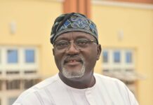
Following the elections, Prof. Timothy Oluwadare Idowu emerged as the President of the association while Dr. Lawrence Hart was elected as the Vice President.
Others are: Dr. Joseph Dodo; Secretary, Dr. Onwuzuligbo Chukwubueze; Assistant Secretary, Dr. Adekunle Ibrahim; Treasurer, Surv. Mary-Rose Okafor; Financial Secretary, Surv. Arungwa Ikenna; PRO, Prof. M. N. Ono; Ex-officio and Dr. V. Uzodinnma was elected as Ex-officio.
In the just concluded annual conference, they revealed that lack of deformation surveys for monitoring of structures is the major factor responsible for frequent building collapse in Lagos state and other major cities in the country.
The association which is a group of scientists and researchers that specialises in scientific areas of surveying, made this revelation in a communique issued at the end of its annual conference, theme “Geodetic Solutions to Multi-Disciplinary Problems”, held at Federal School of Surveying, Oyo.
Our correspondent gathered that no fewer than five buildings among whom are buildings under construction have collapsed in the last five months.
A 21-story building collapsed on November 1st in Ikoyi area of Lagos state. No fewer than fourteen people lost their lives as a result of the incident.
Our correspondent recalls that another building had on November 17th collapsed at Badagry area of Lagos state.
NAG has however said that absence of deformation surveys for monitoring of structures such as high-rise buildings, bridges and dams is responsible for the frequent building collapse in Lagos and other cities.
The association in the communique made available to our correspondent through its President, Professor Timothy Oluwadare Idowu, insisted that the only solution to reduce incessant building collapse across the country is to ensure speedy implementation and compliance to the Federal Government’s policy on deformation monitoring of infrastructures.
NAG in the communique made available to our correspondent in Ibadan on Thursday, suggested that an acceptable format for generation and presentation of deformation monitoring data should also be developed, in order to reduce incessant building collapse across the country.
The association while speaking further explained that the alarming rate of retreating Lake Chad is a major international boundary issue which has consequential conflict potentials in the country.
The association observed that “Absence of deformation surveys for monitoring of structures such as high-rise buildings, bridges and dams is responsible for the frequent collapses of such structures in the country.
“Inadequate monitoring and poor understanding of subterraneous activities particularly in areas of intensive mining results in poor estimation of the environmental impacts of these activities.
“Lack of accurate geoid model for the country is a major problem in the development of a common and unified reference system for the country. Insufficiency of gravity data in the country is a setback for geoid determination and modeling.
“The need to aggressively pursue the provision of geodetic data such as deflection of the vertical components in the country was highlighted.
“The alarming rate of retreating Lake Chad is a major international boundary issue which has consequential conflict potentials for major socio- economic and National security concern”.
NAG while speaking further suggested that there is a need to ensure speedy implementation and compliance to the Federal Government’s policy on deformation monitoring of infrastructures so as to reduce incessant cases of building collapse in the country.
“Speedy implementation and compliance to the Federal Government’s policy on deformation monitoring of infrastructures. An acceptable format for generation and presentation of deformation monitoring data should also be developed.
“An acceptable format for generation and presentation of deformation monitoring data should also be developed.
“A country wide land-based gravity observation campaign should be undertaken to provide sufficient gravity data to facilitate the transformation between ellipsoidal and orthometric heights as well as Geoid determination for the country.
“Establishment of Laplace stations within the Nigerian Geodetic Network, as a matter of necessity, to orient the network-lines and to determine the deflection of the vertical components to provide information on the shape of the geoid.
“Geodetic solutions to the spatial dynamics of Lake Chad retreating shorelines should be adopted for sustainable planning and management of the socio economic activities and the mitigation of environmental impacts of the shoreline retreat, particularly as it relates to the Nigeria border sectors where significant variations are noticeable.
“Setting of Geodetic observation points for subterraneous activities velocity estimation. This is to indicate the flow and directions in order to understand the various subterraneous activities occurring particularly in areas of intensive mining activities and to serve as early warning signal for the protection of lives and properties.
“The use of Visusshrink threshold estimation technique and Standalone computational tool for gravimetric data acquisition to provide a good alternative for optimal separation of gravity anomalies needed for the exploration of underground natural resources. This is because geometric and gravimetric data acquisition requires understanding of regional and local residual anomalies.
“Demystification of the teaching and learning of the science of geodesy through curriculum review for a more practical approach to meet the goals of modern geodesy and to attract more students in our institutions of learning.
“Geodesy should be considered to stand alone as a full Departmental programme in an appropriate Faculty/School within a University and Polytechnic systems to deeply enrich researches in geodesy options like space geodesy, marine geodesy and geophysical exploration amongst others”.


